Usage Of GIS In Cadastral Mapping
Cadastral maps are a digital representation of land records that display all of the borders of various property parcels according to their length, area, and direction. Depending on your needs, you can use these maps to see the ownership status of land parcels in various regions.

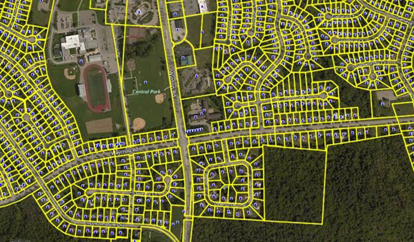
Cadastral maps are a digital representation of land records that display all of the borders of various property parcels according to their length, area, and direction. Depending on your needs, you can use these maps to see the ownership status of land parcels in various regions.
Using Cadastral Maps
The primary justifications for using cadastral maps to locate land records are listed below.
- Cadastral Maps Provide Detailed Information
If you require any information regarding land records, you must use cadastral maps. The Cadastral Mapping primarily gives you information on the property's boundaries and size.
- Significant Time Saver
All you have to do is go to the portal, and you may quickly find the information you need. To obtain information on your property, you can easily use a desktop computer, a laptop, or even a mobile device to access the state's web portal at any time and from any location.
- Ownership Verification:
Producing cadastral maps has this advantage in spades. Before making a purchase, you can use these maps to confirm the property title of a land, structure, or apartment. This assists in preventing you from engaging in any fraudulent transactions.
Reasons to Update Cadastral Maps
Different cadastral maps have been converted to digital format. They continue to display outdated data regarding land piece ownership, though. Based on the information mentioned in textual land records, cadastral maps need to be updated in real-time.
Here are a few reasons for updating cadastral mapping:
- Updated Information
Cadastral maps must be updated in response to textual data changes since the new data contains up-to-date information. These maps need to be updated in real-time so that the information is updated in text records and a digitized copy of land records at the same time.
- Less Property-Related Conflicts
Land records and updated Cadastral Maps can greatly faUpdated Information: facilitate the resolution of legal property-related disputes. Finding accurate information on digitized data can lessen the likelihood of any misunderstandings or confusion.
Application Of GIS Mapping Services in Cadastral Mapping
The integration of GIS technology into mainstream information technology has been challenging due to its high level of sophistication, need for specialized users, and difficulty in use. This has prevented people concerned with land administration from adopting it widely.
The use of GIS for integrating land-related data becomes more advantageous as GIS mapping services and related technologies develop and more data are made available in computer form. But more than just technological problems, increased openness and data integration are frequently perceived as a threat rather than an opportunity. Any system of land administration needs the participation of numerous public and private sector institutions in order to be implemented successfully.
By using GIS mapping services in cadastral mapping, we may even more successfully give accurate and current information on particular local economy strengths, focuses, and advancements to our primary target group of company development managers and location scouts.
Polosoft Technologies being a GIS mapping company uses Land Survey CAD Drafting, GIS, and GPS services to collect and analyze data from sources like land surveys, aerial photographs, and other resources. Dynamic maps are used to present the acquired data once it has been arranged in 2D or 3D formats.
What's Your Reaction?


